ForestVISION
FOREST MANAGEMENT PLATFORM
The ForestVISION (Forest Species Monitoring and Analysing) project encompasses the development of an innovative online platform for the intelligent monitoring, measurement, analysis, and evaluation of large forest patches — for early warning, monitoring, planning and sustainable management, based on artificial intelligence and focused on the specific needs of the Iberian Peninsula. The platform leverages artificial intelligence and computer vision solutions to allow classification of different flora in a forest ecosystem and clustering of the classified species and observable conditions.
The platform provides useful information and early warnings in terms of size, composition, changes (illegal deforestation), health (pests and/or diseases), risks and damages, and an ecological-environmental component that promotes knowledge about forest ecosystem services in a way that effective and efficient for the social, environmental, and economic regeneration of the territory.
The AI capabilities paired with team management tools, intuitive interface, and early warning systems, enable a platform sustainable for planning and management of forests. The project’s focus are the forests of the Iberic Peninsula, with pilot projects located in the Beiras and Serra da Estrela area and the Beira Baixa in Portugal, as well as the Estremadura region in Spain. The platform uses data from different sources like satellite or drone imagery of different types, like RGB and spectral imagery, as well as data augmentation with publicly available ground sensors, like temperature or humidity sensors.
We Have the Power to Impact Our Future, and We’re Doing Something About It
Our goal, is the prevention of natural hazards, strengthening the capacity to adapt to climate change and efficient management of resources, namely in transboundary ecosystems.
The ForestVISION project fits into the typology of “Innovative Pilot Projects”, and the main result of the project is an online platform for the monitoring, measurement, analysis and intelligent evaluation of forest patches that will allow alert, follow-up, planning and sustainable management, based on artificial intelligence and focused on the forests of the Iberian Peninsula, starting in the area of Beiras and Serra da Estrela and Beira Baixa in Portugal and in the Estremadura area in Spain.
The platform will use data from different sources such as satellite and drone multispectral and hyperspectral images as well as data from more traditional sensors, such as temperature, humidity, sun exposure sensors, etc. This data can be obtained through direct measurement or through connection to external sources, such as satellite imagery or meteorology services.
The data is processed by the platform through methodologies for processing large volumes of data, permanently stored in order to build a timeline of changes in the values collected. Then, they are pre-processed and analyzed by artificial intelligence algorithms, in this case using both computer vision and machine learning techniques. The information from the analysis of these data is then used for various functions, such as grouping trees of the same species, estimating the health status of trees, predicting risks or assessing damage.
Different algorithms and models will make it possible to analyze and predict several important factors for the sustainable management of forest patches, such as comparisons between different reforestation methods, between different varieties of trees or the monitoring of factors that can facilitate the occurrence of disasters.
ForestVISION supports:
1) Scientific-technological cooperation between cross-border entities for the sustainable development of the interior, in the area of Beiras and Serra da Estrela and Beira Baixa in Portugal and in the area of Estremadura in Spain,
2) The enhancement of local resources and skills.
3) Their consolidation by qualified human resources and innovative technologies.
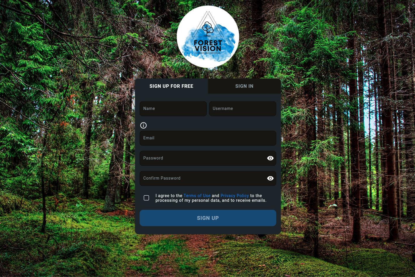
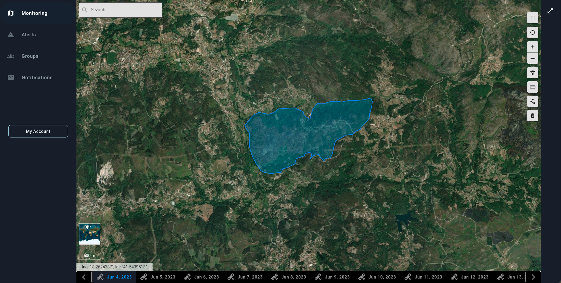
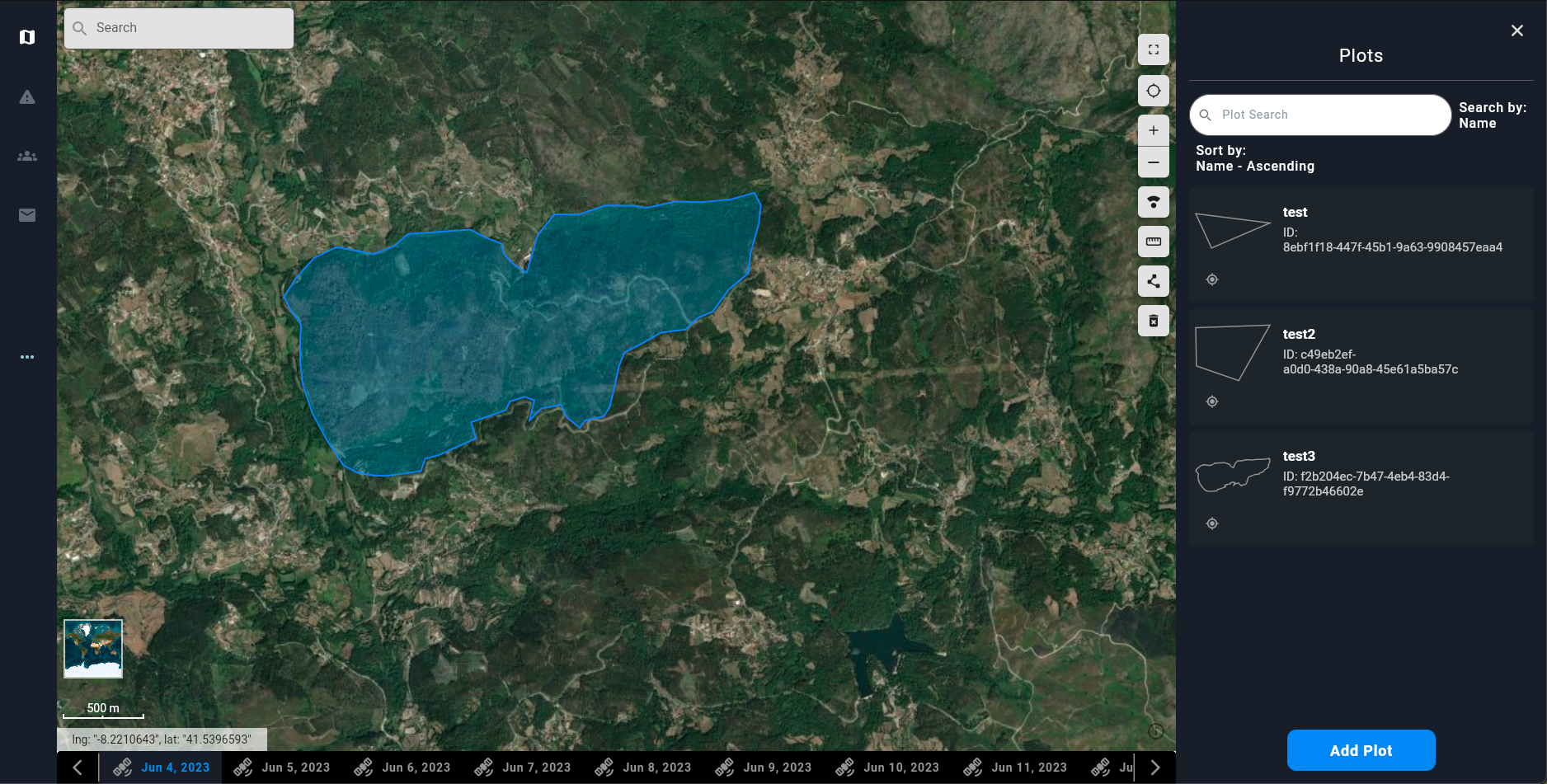
ForestVISION Platform coming soon!
Here is a sneak peak.
Xnip2023-07-03_18-36-01
Xnip2023-07-03_18-35-45
Xnip2023-07-03_18-26-52
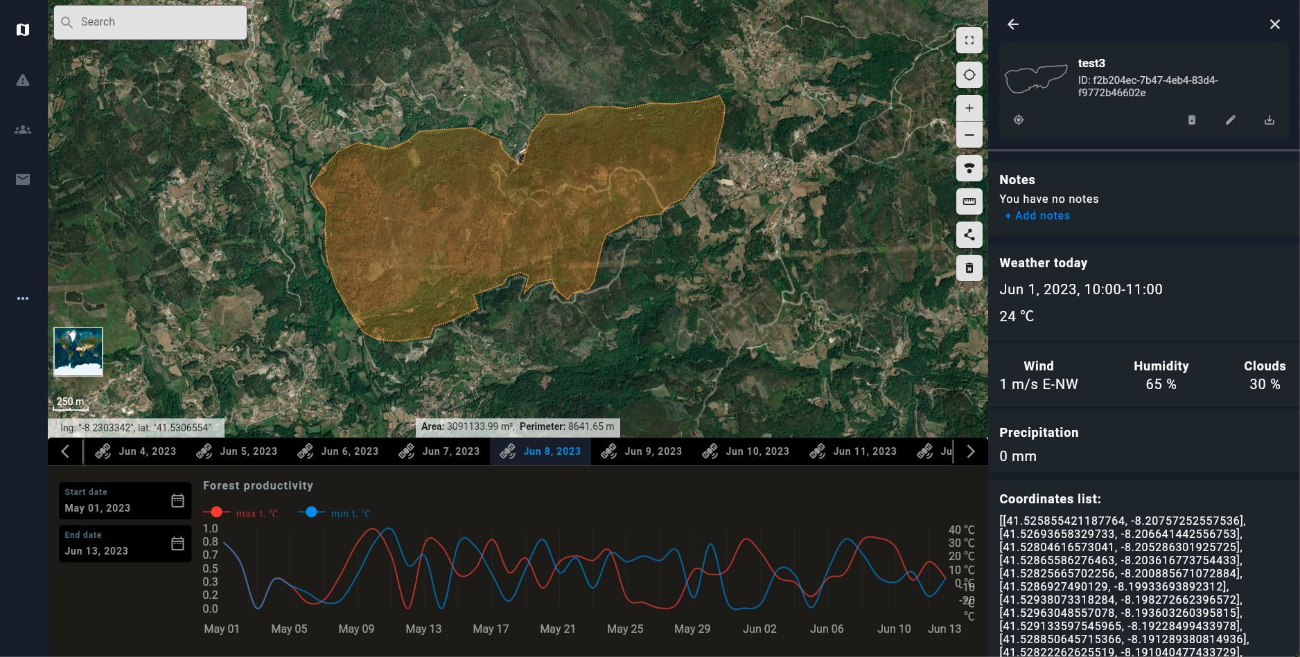
Xnip2023-07-03_18-27-08
Main Benefits
Save Time
- Periodic report generation
- Access the most up-to-date data on your forest plots wherever you are
- Remote monitoring and alerts on your plots
Save Money
- Prevent and reduce loss due to damage with continuous monitoring alerts
- Cut extra costs by monitoring forest stands remotely
- Predict costs based on periodic reports
Convenience
- Stay up-to-date on the condition of your plots wherever you are
- Up-to-date forest mapping and information
- See the latest satellite captures on your plots
- Monitor forest health, compare stands before and after deforestation, and more, all in one place
- Continuous monitoring of the state of your plots with automatic alerts if anything unusual is detected
Sustainability
- Reduce the negative deforestation effects on the carbon cycle remotely
- Detect illegal logging thanks to satellite-based deforestation maps
- Detect fires or other hazardous conditions
Key Features
Monitoring
- Remotely monitor your plots anywhere in the world
- Monitoring of hazardous conditions and forest health
- Deforestation satellite monitoring
- Regular high-resolution multispectral satellite captures
Alerts and Notifications
- Set custom alerts on your plots and get notified if any condition is verified
- Regular satellite captures for continuous report generation and alert tracking
Management
- Create user groups for team integration
- Manage user groups by assigning plots and sending alerts to multiple users
- Remotely plan forest activities and orchestrate with teams on the ground
Machine Learning Engine
- Have access to cutting-edge ML models that predict and detect the condition of your plots
- Track and monitor multiple conditions and use cases
- Get periodic reports on the state and evolution of your plots
Publications and Results
Publications and results related to the ForestVISION project will be added here.
Our Partners & Sponsors
Partners


Sponsor
In Cooperation With